









Introduction: The Navigation Revolution
For decades, navigating Accra meant relying on landmarks—”after the big tree, turn left at the blue house.” For visitors and even many residents, finding addresses was an exercise in patience and local knowledge. Emergency services struggled to locate accident scenes. Delivery drivers wasted hours searching for destinations. The absence of a formal street addressing system was not just an inconvenience; it was a barrier to efficient transport, commerce, and even life-saving emergency response.
GPS technology has fundamentally changed this reality. What was once a luxury is now becoming infrastructure. From ride-hailing apps that connect passengers to drivers in seconds to fleet tracking systems that monitor commercial vehicles across the city, from a homegrown navigation app that now gives millions access to ambulance services to AI-powered platforms optimising public transport routes, GPS is reshaping how Accra moves .

This Accra Street Journal article explores the transformative impact of GPS technology on transportation in Accra—examining the rise of ride-hailing platforms, the growth of fleet management, the potential of AI-powered public transport optimisation, and the recent launch of indigenous solutions like Mijo on the GhanaPost GPS platform .
📢 GET A DETAILED ARTICLES + JOBS
Join ASJ's WhatsApp Channel and never miss a post or opportunity.

Part 1: The Foundation – GhanaPost GPS and SnooCode
Solving the Addressing Problem
The fundamental challenge for GPS-based services in Accra has always been the lack of a formal street addressing system. Without reliable addresses, even the most sophisticated GPS technology cannot guide you to a destination.
The GhanaPost GPS platform, developed with support from the Ghana Post Company, has addressed this gap. Integrated with the national digital addressing system, the platform allows users to generate unique alphanumeric codes for any property in Ghana . With over 4 million downloads and more than 100,000 active users at any given time, it has become the backbone for location-based services across the country .

SnooCode: A Revolutionary Navigation App
One of the most impactful innovations building on this foundation is SnooCode, developed by University of Warwick graduate Sesinam Dagadu. The app generates a unique alphanumeric code for each property in Ghana and uses GPS to pinpoint the exact location .
Most critically, SnooCode works without an internet connection—a transformative feature in a country where connectivity can be inconsistent. For the first time in the history of the ambulance service in Ghana, 8.7 million people can now be reached by paramedics using this app in the most hostile conditions .
The impact extends beyond emergency services. Taxi drivers, couriers, food delivery drivers, and garbage collection services can use the app. The same code can even be used in place of a physical address to open a bank account .
The World Health Organisation (WHO)’s African Network for Drugs and Diagnostics Innovation (ANDi) has identified SnooCode as a key technology in providing timely emergency care across Africa and in the battle against infectious and vector-borne diseases like malaria, cholera, and Ebola, by allowing healthcare professionals to identify the centres of disease and other outbreaks .
Part 2: The New Frontier – Mijo Ride-Hailing App
An Indigenous Solution Launches May 1, 2026
April 19, 2026, Accra – After weeks of successful pilot, indigenous ride-hailing platform Mijo on the Ghanapost GPS App will officially launch on May 1, 2026 . This launch marks further innovation within the GhanaPost GPS ecosystem, enabling users not only to identify locations but to seamlessly request rides and facilitate deliveries directly through the platform .
Mijo is designed to deliver a reliable, user-friendly, and affordable experience for riders while creating meaningful economic opportunities for drivers. Key features include:
-
Driver-first model: Offers favourable commission rates compared to other ride-hailing platforms, ensuring drivers retain a larger share of their earnings, empowering them financially and supporting long-term planning .
-
Executive service: Beyond standard ride options, users have access to premium vehicles for a more comfortable experience .
-
Social impact during pilot: The platform provided free and discounted rides to students, healthcare workers, and other professional groups across Accra, while drivers benefited from responsive customer support and prompt payments .
Mijo marks a significant milestone in Ghana’s push for homegrown digital innovation, contributing to job creation, income growth, and financial independence for thousands of Ghanaian drivers .
Existing Ride-Hailing Options
Mijo joins other GPS-enabled ride-hailing services in Accra, including OGB Ride. OGB Ride uses “the most up-to-date GPS technology to directly connect you with a Ghana driver within a range” . It employs an intelligent queue algorithm that forms a queue of all cab drivers within 5 minutes to reach the passenger based on the driver’s waiting time, distance, and rating .
The growth of these platforms demonstrates how GPS technology has democratised access to transport—turning any smartphone into a taxi-hailing device and creating flexible income opportunities for thousands of drivers.

Part 3: Fleet Management – Tracking Commercial Transport
The Growth of GPS Fleet Tracking
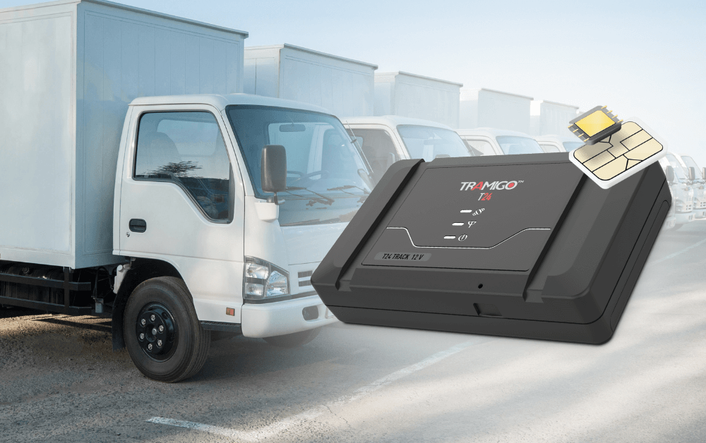
Beyond passenger transport, GPS technology is revolutionising commercial fleet management in Accra. Companies operating delivery vans, trucks, and logistics fleets are increasingly adopting GPS tracking solutions to optimise operations.
Protrack Ghana, a company based in Accra founded in 2016, offers GPS tracking solutions for fleet operators. Its platform includes location tracking, anti-theft systems, smart dash cams, and more . Such solutions enable fleet managers to:
-
Monitor vehicle locations in real time
-
Optimise routes to reduce fuel consumption
-
Track driver behaviour and safety
-
Improve response times for deliveries
The Ghana Fleet Management System market is projected to grow significantly between 2025 and 2031, with GPS tracking being the dominant technology segment . Key applications driving this growth include:
| Application | Benefit |
|---|---|
| Route Optimization | Reduced fuel costs, faster deliveries |
| Fuel Management | Detection of inefficiencies and theft |
| Driver Behavior Analysis | Improved safety, reduced accidents |
| Maintenance Tracking | Preventative maintenance, reduced downtime |
Part 4: Public Transport – The Promise of AI and GPS Integration
The Challenge of Informal Transport
Accra’s public transport system is dominated by “trotros” – privately operated minibuses that form the backbone of urban mobility for millions of residents. However, the system is largely informal and decentralised. There is no real-time tracking, no route optimisation, and no centralised planning .
TroTroIQ: AI-Powered Optimisation
TroTroIQ is an AI-powered platform designed to address these gaps. While still a prototype (developed at a hackathon), it illustrates the potential of integrating GPS and data analytics into public transport planning .
The platform aims to:
-
Suggest optimal routes between any two locations
-
Predict demand and viability of new or existing routes
-
Visualise transport patterns using real-time and historical data
-
Help commuters and planners make data-informed decisions
-
Integrate GTFS and GPS data to show the current state of the network
Future plans for TroTroIQ include:
-
Deploying on Google Play and gathering commuter feedback
-
Integrating fare estimation, traffic prediction, and timetable optimisation
-
Partnering with local municipalities to pilot in real-world settings
-
Open-sourcing the platform for other African cities
Existing Navigation Apps for Public Transport
Basic GPS-enabled navigation for public transport already exists in Accra. The Trotro app provides full door-to-door navigation, multiple types of public transport (bus, minibus), and multiple route suggestions. It uses GPS to show the user’s position on the map, making it easier to navigate the city’s complex public transport network .
Part 5: Emergency Services – Saving Lives with GPS
Transforming Ambulance Response
The most profound impact of GPS technology in Accra may be in emergency services. As noted, SnooCode has enabled paramedics to reach 8.7 million people for the first time in the history of Ghana’s ambulance service, even in conditions with no internet connection .
This capability is not merely convenient—it is life-saving. In medical emergencies, every minute counts. GPS-enabled navigation that works offline removes a critical barrier to timely emergency care.
Future Possibilities
As GPS technology continues to integrate with emergency response systems, the potential applications expand:

-
Real-time tracking of emergency vehicles
-
Optimised routing based on live traffic conditions
-
Integration with hospital capacity data to direct patients to the nearest available facility
-
Public emergency alert systems that use location data to target warnings
Part 6: Law Enforcement – Automated Traffic Enforcement
Traffitech-GH: The Police Invisible Eyes
While not a GPS application per se, GPS technology is integral to the Ghana Police Service’s automated traffic law enforcement system, Traffitech-GH (Police Invisible Eyes). The system uses cameras and sensors to automatically record vehicles that flout road traffic laws and regulations, including speeding and jumping red lights .
The system automatically transfers recorded pictures and/or videos to a back office for validation and issuance of a notification by SMS to the vehicle owner for payment. The notification includes the location, date and time of the traffic offence, as well as the vehicle registration number, offence description and payment amount and deadline .
Other offences that will be enforced under Traffitech-GH include:
-
Expired road worthiness certificate
-
Wrongful overtaking
-
Non-use of seatbelts
-
Use of mobile phones while driving
-
Use of expired license
-
Driving with an uninsured vehicle
-
Abuse of siren
The Road Safety Imperative
According to the National Road Safety Authority (NRSA), speeding contributes to more than 60 per cent of all collisions, crashes and injuries in Ghana, making the use of technology to tackle speeding crucial to road safety . Automated enforcement removes human discretion, reduces corruption, and ensures consistent application of traffic laws.
Part 7: The Challenges Ahead
Infrastructure Gaps
Despite significant progress, GPS-based services in Accra still face challenges:
-
Connectivity gaps: While offline capabilities help, real-time applications depend on reliable internet connectivity, which remains inconsistent in some areas.
-
Battery consumption: GPS-based apps can drain smartphone batteries quickly, limiting their utility for all-day use.
-
Data costs: For many Ghanaians, the cost of mobile data remains a barrier to using GPS-enabled services regularly.
Data Quality and Integration
The TroTroIQ project highlighted a key challenge: the lack of reliable real-time transport data . Incomplete GTFS datasets and the absence of live GPS feeds from buses make it difficult to build truly dynamic public transport optimisation systems.
Trust and Adoption
New platforms like Mijo must build trust with both riders and drivers. The pilot phase’s focus on student and healthcare worker discounts demonstrates an awareness of this challenge, but widespread adoption takes time.
Key Takeaways at a Glance
| Technology | Application | Impact | Status |
|---|---|---|---|
| GhanaPost GPS | Digital addressing, location codes | 4M+ downloads, 100K+ active users | Live |
| SnooCode | Offline navigation for emergency services | 8.7M people now reachable by ambulances | Live |
| Mijo | Indigenous ride-hailing platform | Job creation, driver-first model | Launching May 1, 2026 |
| OGB Ride | GPS-enabled taxi hailing | Affordable rides, queue algorithm | Live |
| Protrack Ghana | Fleet tracking for commercial vehicles | Location tracking, anti-theft, dash cams | Live |
| TroTroIQ | AI-powered public transport optimisation | Route suggestions, demand prediction | Prototype |
| Traffitech-GH | Automated traffic law enforcement | Speeding, red light, seatbelt enforcement | Rolling out |
Frequently Asked Questions (FAQs)
1. What is the GhanaPost GPS platform?
The GhanaPost GPS platform is a digital addressing system integrated with the national post. Users can generate unique alphanumeric codes for any property in Ghana. The platform has over 4 million downloads and more than 100,000 active users .
2. What is SnooCode and how does it help emergency services?
SnooCode is a navigation app that generates unique codes for properties and uses GPS to pinpoint exact locations. Critically, it works without an internet connection. For the first time in Ghana’s history, 8.7 million people can now be reached by paramedics using this app .
3. When does the Mijo ride-hailing app launch?
Mijo officially launches on May 1, 2026, after a successful pilot phase. It operates on the GhanaPost GPS platform, enabling users to request rides and deliveries directly through the app .
4. What is the driver-first model of Mijo?
Mijo offers favourable commission rates compared to other ride-hailing platforms, ensuring that drivers retain a larger share of their earnings. The platform aims to empower drivers financially and support long-term planning .
5. What is TroTroIQ?
TroTroIQ is an AI-powered platform that aims to optimise Accra’s public transport using real-time GPS, GTFS data, and commuter analytics. It can suggest optimal routes, predict demand, and visualise transport patterns .
6. How does GPS technology help fleet operators in Accra?
Companies like Protrack Ghana offer GPS tracking solutions that include location tracking, anti-theft systems, and smart dash cams. These enable route optimisation, fuel management, driver behaviour analysis, and maintenance tracking .
7. What is Traffitech-GH?
Traffitech-GH is an automated system by the Ghana Police Service that uses cameras and sensors to automatically record vehicles that violate traffic laws, including speeding and jumping red lights. Offenders receive SMS notifications with payment details .
8. Does SnooCode work without internet?
Yes. A key feature of SnooCode is that it works even in conditions where there is no internet connection, making it invaluable for emergency services .
9. How many people use the GhanaPost GPS platform?
The GhanaPost GPS platform has over 4 million downloads and more than 100,000 active users at any given time .
10. What percentage of road accidents in Ghana are caused by speeding?
Speeding contributes to more than 60 per cent of all collisions, crashes, and injuries in Ghana .
Conclusion: A Navigation Revolution Underway
The transformation of transportation in Accra through GPS technology is not a future possibility—it is happening now. From the launch of Mijo on May 1, 2026, to the life-saving capabilities of SnooCode, from AI-powered public transport optimisation to automated traffic enforcement, GPS is reshaping how Accra moves .
The foundation for this transformation is the GhanaPost GPS platform and its 4 million users. On this foundation, a diverse ecosystem of applications has emerged—ride-hailing, fleet tracking, offline navigation, emergency response, and public transport planning.
Yet challenges remain. Connectivity gaps, data quality issues, and the need for broader adoption all require continued investment and innovation. But the direction is clear. The city that once navigated by landmarks and guesswork is becoming a city that moves with precision, efficiency, and safety.
For the millions of Ghanaians who depend on Accra’s transport system every day, this is not merely a technological upgrade. It is a transformation in how they work, how they access services, and how they live.
Source: Accra Street Journal
Last Updated on April 27, 2026 by Samuel Kwame Boadu
Disclaimer: Some content on Accra Street Journal may be aggregated, summarized, or edited from third-party sources for informational purposes. Images and media are used under fair use or royalty-free licenses. Accra Street Journal is a subsidiary of SamBoad Publishing Hub under SamBoad Business Group Ltd, registered in Ghana since 2014.
For concerns or inquiries, please visit our Privacy Policy or Contact Page.

Samuel Kwame Boadu is a Ghanaian media entrepreneur and storyteller with a passion for amplifying urban voices and uncovering everyday truths. He is the Editor-in-Chief and Founder of Accra Street Journal, a dynamic digital platform dedicated to capturing the pulse of Ghana’s capital—its people, culture, challenges, business, sports and innovations.